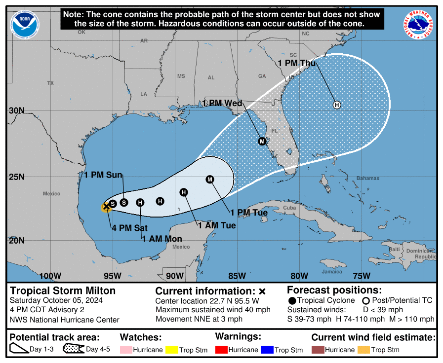
Tropical Storm Milton has officially formed in the Gulf of Mexico after midday data confirmed the storm’s winds reaching 40 mph (35 knots). The storm’s center is well-defined but remains small in size, with tropical-storm-force winds covering a limited area. While Milton is still in its early stages, it’s expected to strengthen in the coming days.
Current Status:
- Winds: 40 mph (35 knots)
- Movement: Drifting north-northeast at 3 mph
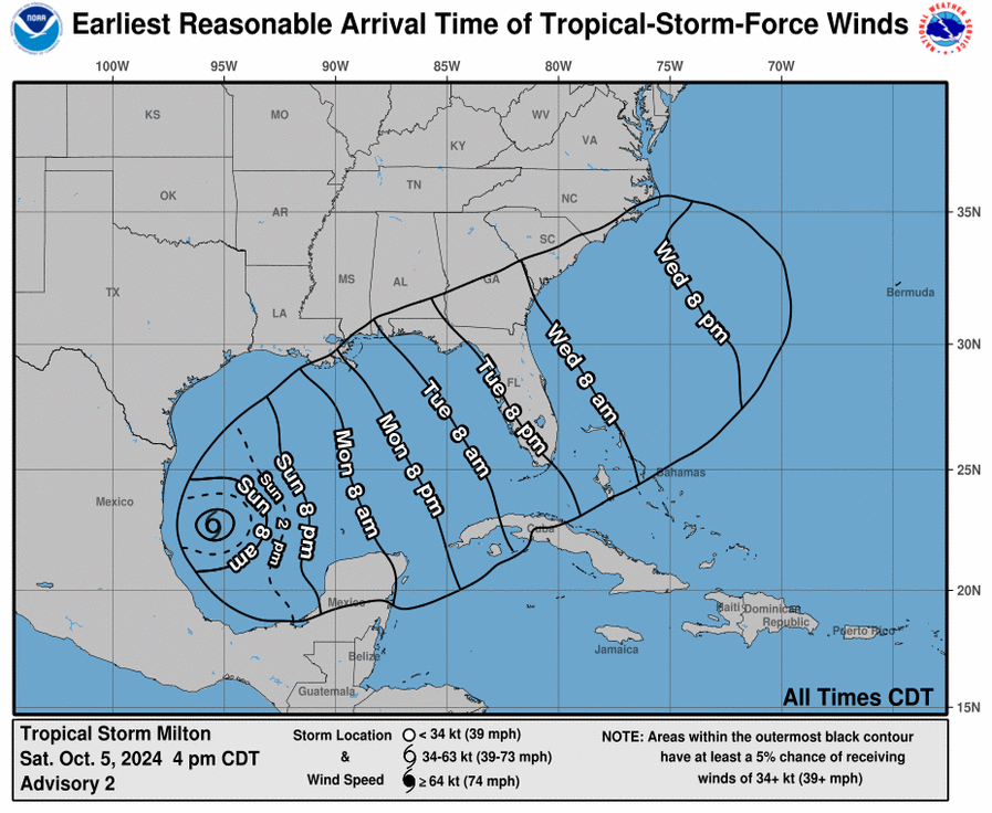
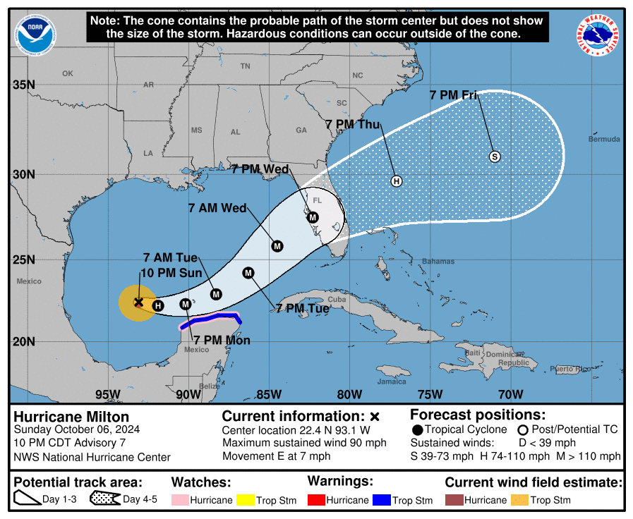
As of now, the storm isn’t moving much, but it’s expected to start heading eastward on Sunday and pick up speed by Monday. By Tuesday night, Milton could be approaching Florida’s west coast. However, there’s still uncertainty about the exact timing and track, so it’s important to stay updated. Forecasts often vary by about 150 miles for storms at this range.
Forecast: Milton is in an environment with favorable conditions for rapid strengthening. It’s expected to become a hurricane in the next day and a major hurricane by midweek. Models suggest the storm could intensify quickly, potentially bringing dangerous impacts to the west coast of Florida.
Key Messages:
- Intensification Expected: Milton is forecast to quickly strengthen and could reach major hurricane strength as it nears Florida’s west coast around midweek.
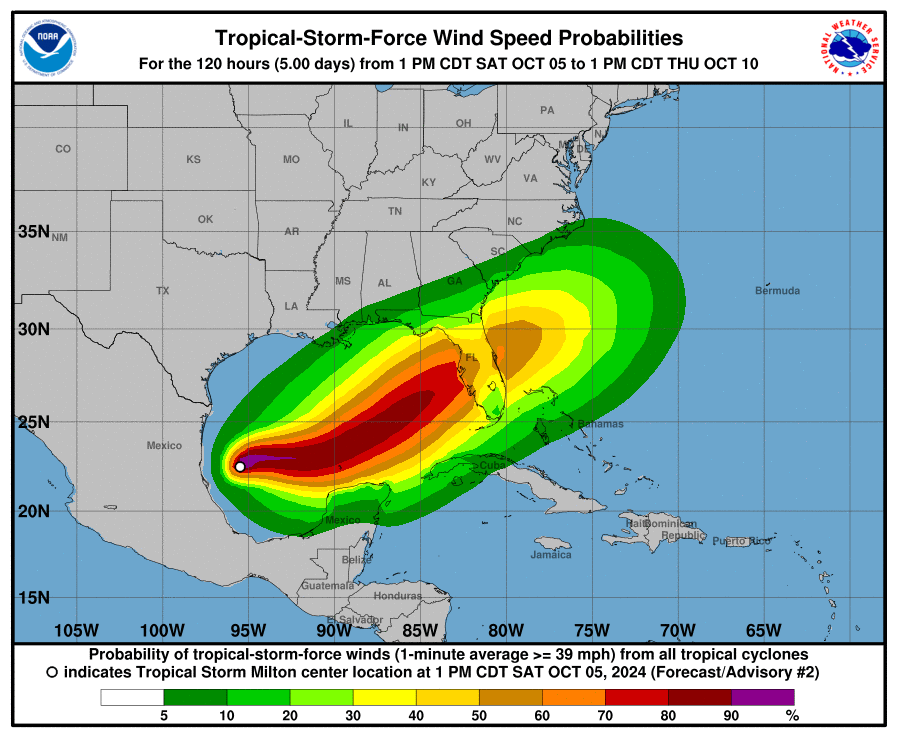
- Life-threatening Storm Surge and Wind: The Florida Peninsula’s west coast could face dangerous storm surge and strong winds starting late Tuesday or Wednesday. Residents should prepare and follow advice from local officials.
- Heavy Rainfall and Flooding: Rainfall could affect parts of Florida as early as Sunday, with heavier rain directly tied to Milton expected Tuesday through Wednesday. This rain increases the risk of flooding in urban and low-lying areas, along with rivers.
Residents along the Florida Peninsula should prepare for potential impacts from this storm and stay informed with the latest updates.


