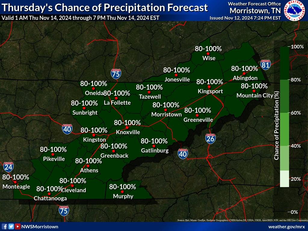
A robust cold front is set to sweep across the region on Thursday, bringing widespread rain and gusty winds as it moves through.
Timing and Rainfall
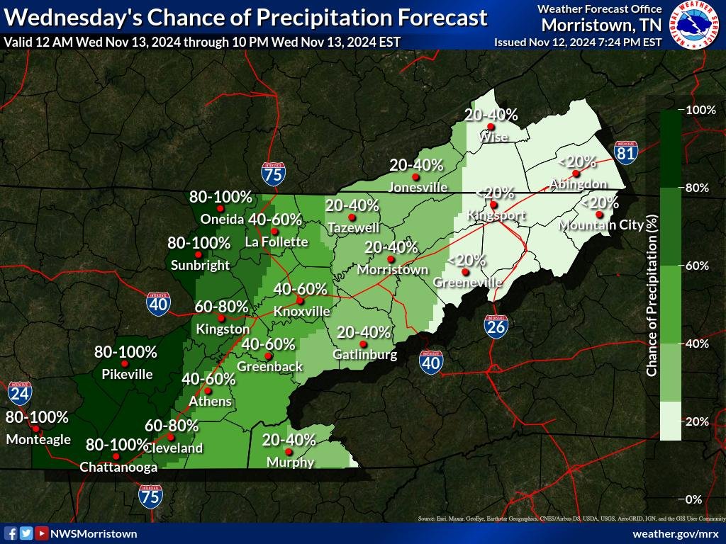
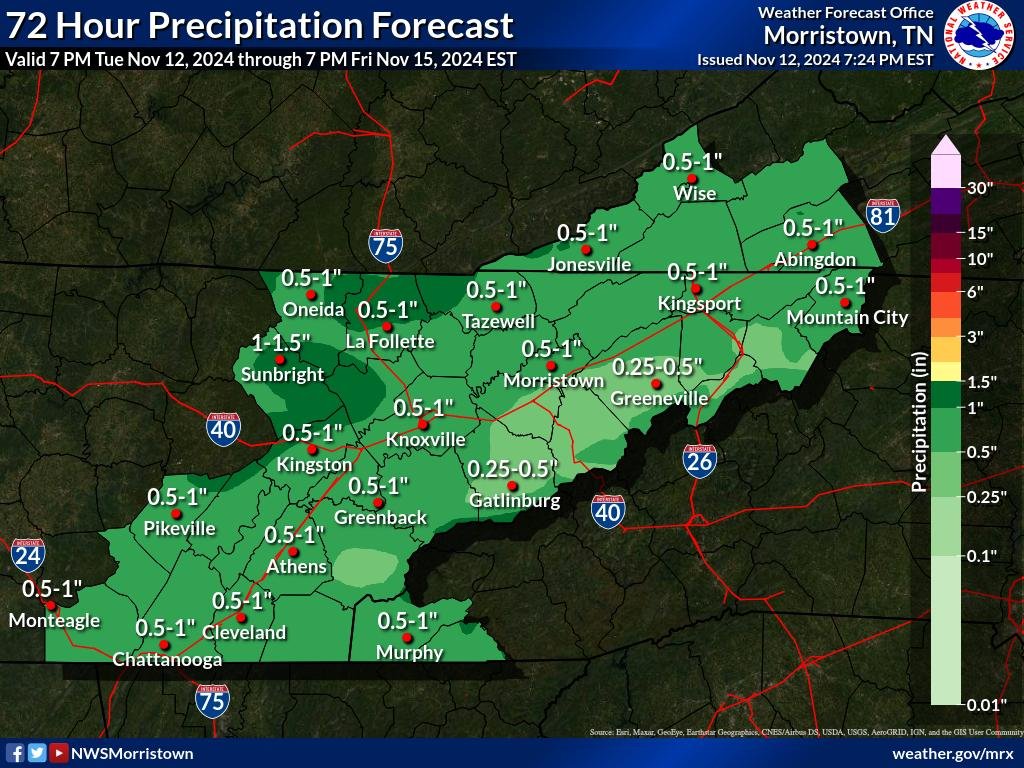
Rainfall is expected to begin late Wednesday night and continue into Thursday morning, driven by a pronounced trough moving through the central United States. The bulk of the precipitation will occur overnight, tapering off by Thursday afternoon as the system pushes eastward. While rain will be widespread, totals are forecasted to be beneficial overall. Most areas away from the mountains may receive around an inch of rain, with slightly lower amounts—approximately half an inch—expected in foothill counties. This rain will be welcomed by many, helping to alleviate any lingering dry conditions.
Gusty Winds
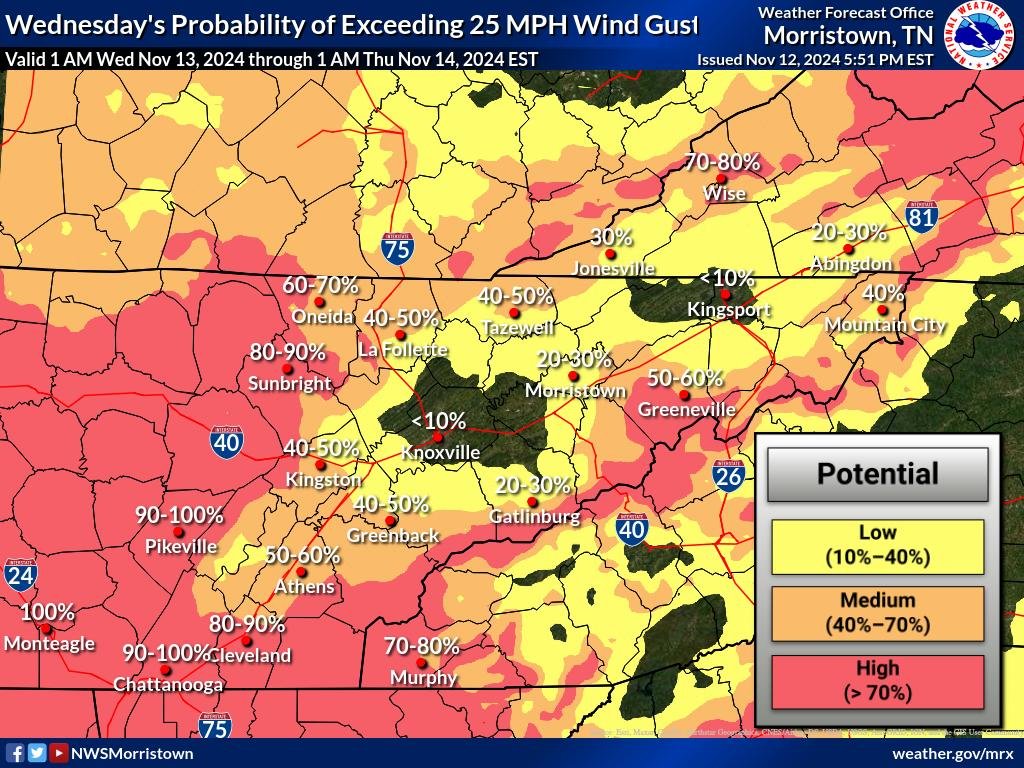
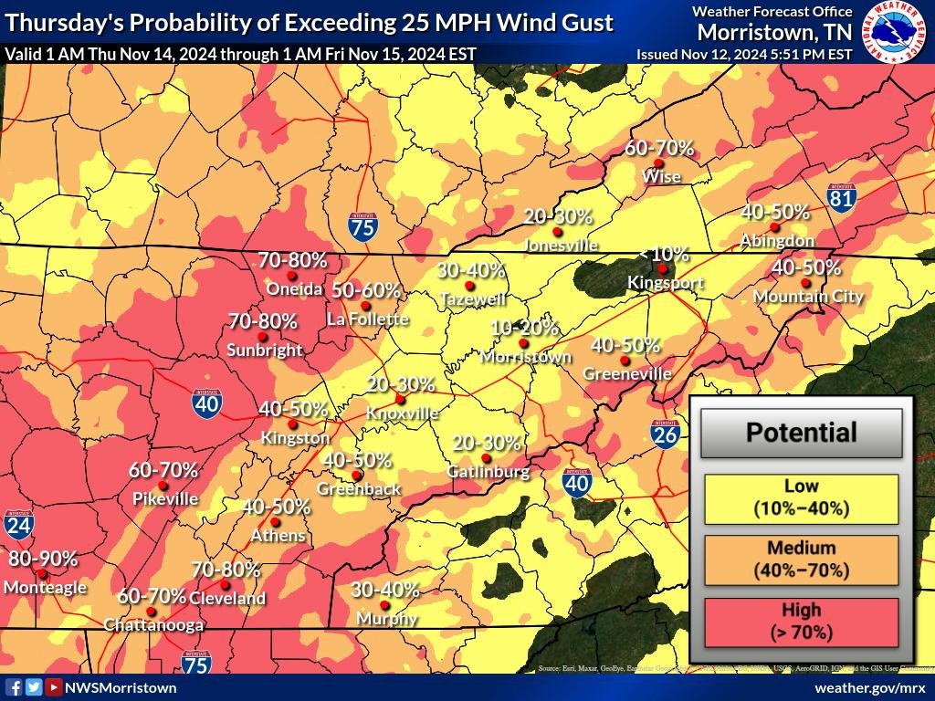
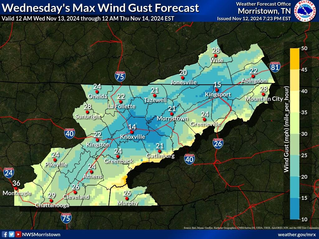
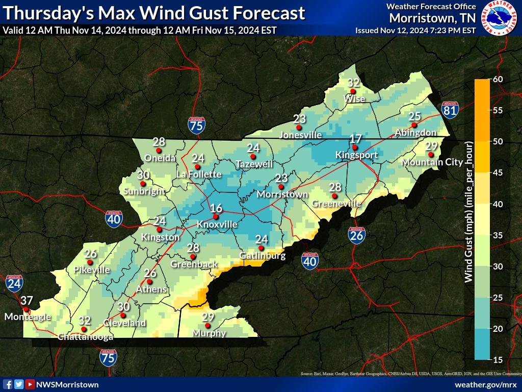
In addition to the rain, strong gusty winds will accompany the front. As a low-level jet stream strengthens ahead of the trough, wind speeds of 40 to 60 MPH are expected to impact the area. The orientation of these winds relative to the mountains—blowing at nearly a perpendicular angle—will create particularly gusty conditions in foothills and along the Tennessee-North Carolina border. Wind gusts during the overnight hours may approach advisory criteria, creating potentially hazardous conditions for those in wind-prone locations.
Isolated Thunder and Overnight Wind Surge
While instability is limited, there is a slight chance of isolated thunder during the overnight period due to a small amount of elevated instability. Thunderstorms are not expected to be severe, but they may enhance local wind gusts briefly. The strongest winds are likely to occur during the late night and early morning hours, gradually diminishing as the jet stream weakens and the front moves further east by Thursday afternoon.


