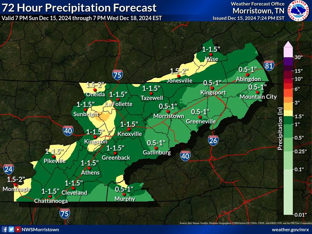
A shift in weather patterns will bring renewed rain chances to our region this week. Beginning Monday night, a shortwave system will move north and east through the Ohio River Valley, bringing light rainfall to the area. While the latest ensemble models suggest the chance of 12-hour precipitation greater than or equal to 0.25″ is at 40% or less, higher chances are concentrated along the Cumberland Plateau. For areas east of the Plateau, probabilities drop to 20% or less, indicating that rainfall amounts are likely to remain light due to limited upper-level forcing.
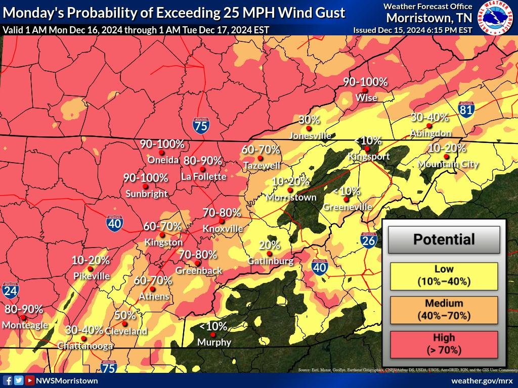
In addition to the rain, breezy conditions are expected. Winds exceeding 20 mph are forecast for higher terrain areas, including southwest Virginia, the northern Plateau, and the east Tennessee mountains. These breezy conditions will persist from Monday night through mid-morning Tuesday.


Midweek System Brings Greater Rain Potential
After a brief break in precipitation, a more significant weather system is expected to impact the area by midday Wednesday, continuing into the evening. This system is associated with a surface front. Current projections show a 50-70% probability of receiving 0.50″ or more of rain across much of the valley.
There is also a slight chance of thunderstorms as minor atmospheric instability develops. Latest GFS model soundings indicate instability values below 500 J/kg, suggesting the potential for a few rumbles of thunder, though severe weather is not expected at this time.


