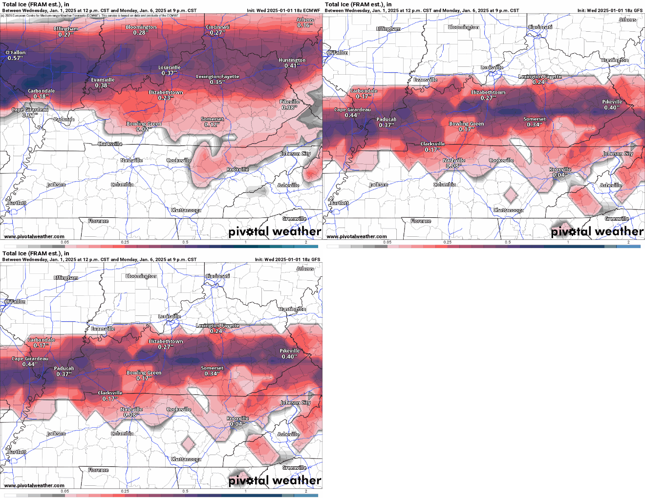
9 PM Update 1/1/25: The latest model runs are in, and they continue to indicate the potential for ice accumulation Sunday evening into Monday across the region, transitioning to cold rain by Monday afternoon and evening. Here’s a breakdown:
- Knoxville:
- GFS: Predicts 0.04″ of ice.
- Euro: Slightly higher, but still under 0.10″.
- Trend: This is a slight downtrend compared to earlier runs.
- Plateau and Tri-Cities:
- GFS: Some areas near the TN/VA line could see up to 0.30″.
- Euro: Slightly lower at 0.20″, but still enough to create hazardous conditions, especially in areas already prone to driving challenges during sunny days as-is.
The models disagree on the timing of the system’s arrival, adding uncertainty to these predictions.
Next Steps:
While uncertainty remains, preparation and awareness are essential at this stage. We’re holding off on another social media update until Thursday evening to gather more data and include input from the NAM model.

Original Article
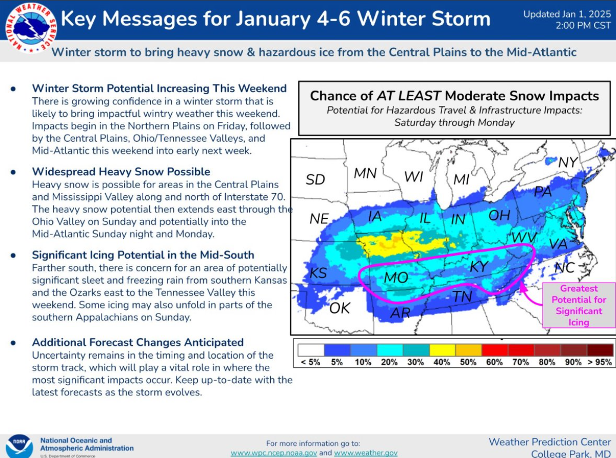
As we head into Sunday night and Monday morning, all attention turns to an approaching low-pressure system that is expected to pass somewhere nearby. While its exact path remains uncertain, this system could bring impactful winter weather to the region. Here’s what we know so far:
Emerging Trends
The latest weather model runs, including the Euro and GFS, have shown a noticeable northern trend in the low-pressure system’s projected track. While this shift is cautiously good news for those in the valley—indicating predominantly rain—it doesn’t completely rule out ice accumulation. For now, it’s important to note that this is just a trend, not a set forecast.
Confidence in Ice Potential
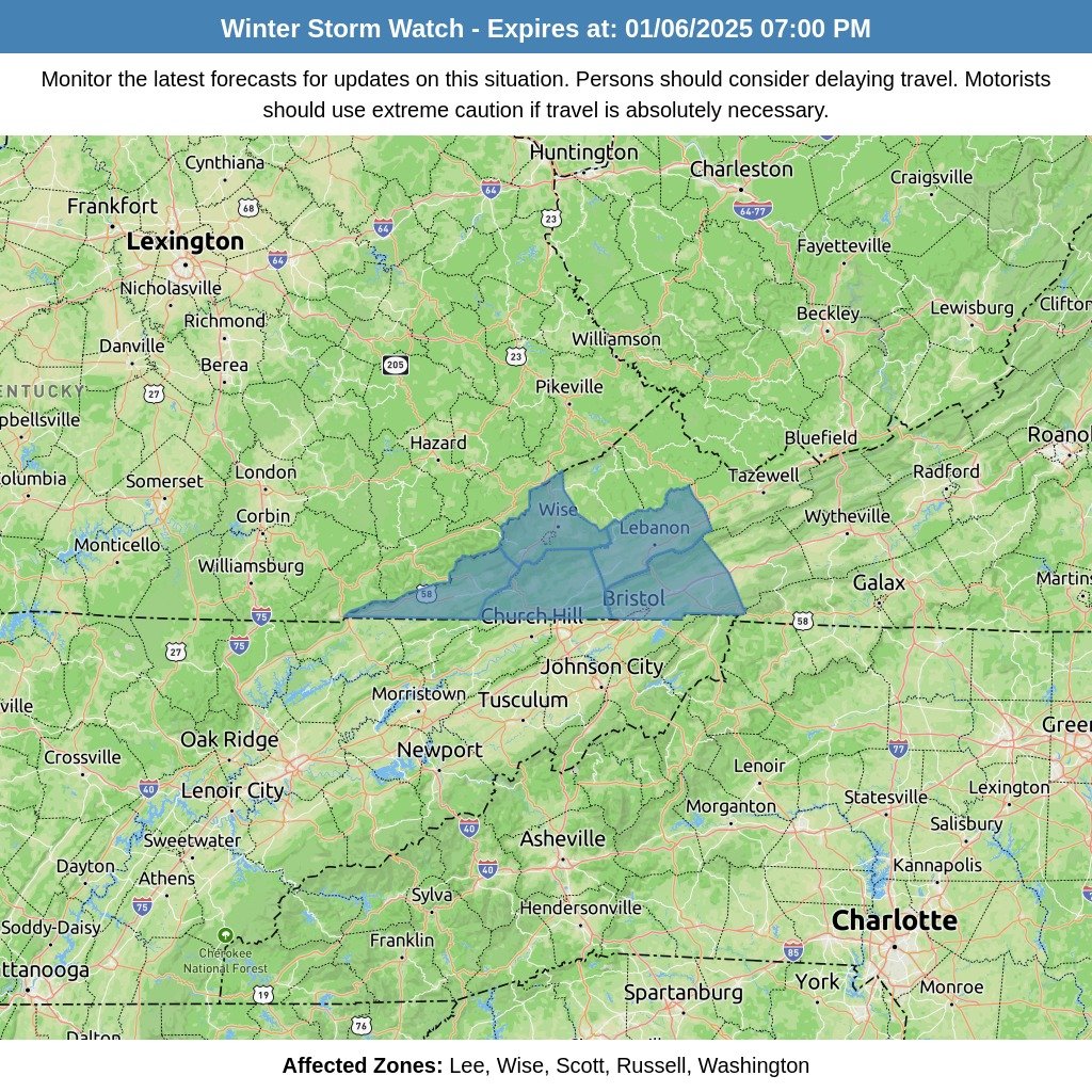
One growing consensus among weather models is the likelihood of icing within the region. What remains unclear is the severity—will it be light enough to cause minor disruptions, or significant enough to “shut the city down”? All models agree that the Cumberland Plateau is the area most likely to experience substantial mixing and icing, making it the primary focus for concern.
Snowfall Expectations
When it comes to snow, the models are showing consistency for higher elevations, predicting several inches of accumulation. Meanwhile, the valley might see only a dusting to an inch. This is not an official forecast, but if the low-pressure system shifts southward, snow totals could increase. This is a development that will need to be closely watched over the coming days.
Why This Matters
The exact track and timing of this system are still too uncertain to provide a reliable forecast. However, it’s clear that the potential for impactful weather exists, whether it’s rain, ice, or snow.
As the National Weather Service puts it:
“This will need to be monitored closely over the next few days because a shift in the track of the surface low and/or a resolution in timing differences will have significant impacts on the forecast.”
What You Can Do
The best course of action is to stay informed. Keep an eye on weather updates as this system develops, and be prepared for potential winter weather impacts. We’ll continue monitoring the situation and will provide updates as more information becomes available.


