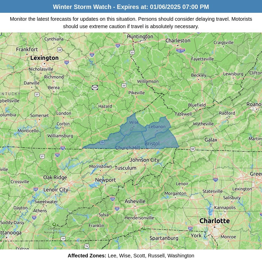
A significant winter weather event is on the horizon for the mountains, beginning early Wednesday morning and continuing through Wednesday night. As a weather front sweeps through the region, rain will transition to snow, bringing the potential for accumulating snowfall in higher elevations and light snow in some valley locations.
Cold Air Surge and Temperature Drop
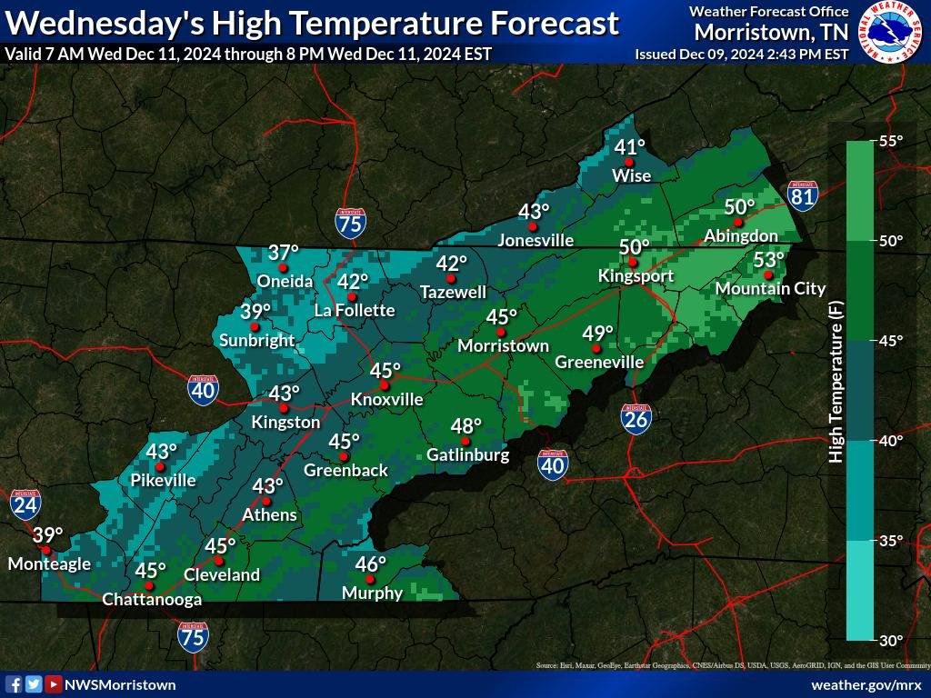
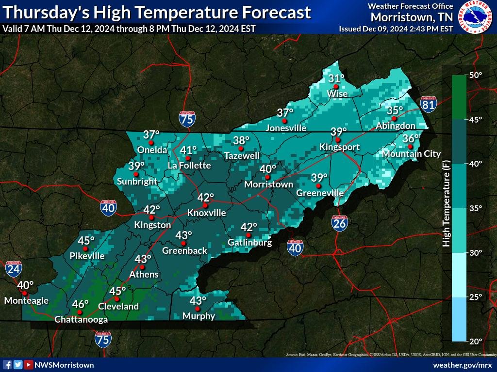
A powerful influx of dry, cold air will arrive early Wednesday, triggering a rapid decline in temperatures throughout the day. In fact, the day’s highest temperature is expected just after midnight, with temperatures steadily falling as the cold front moves through. This cold air mass, combined with a shift to northerly winds, will create favorable conditions for upslope snowfall across higher elevations.
Snowfall Projections
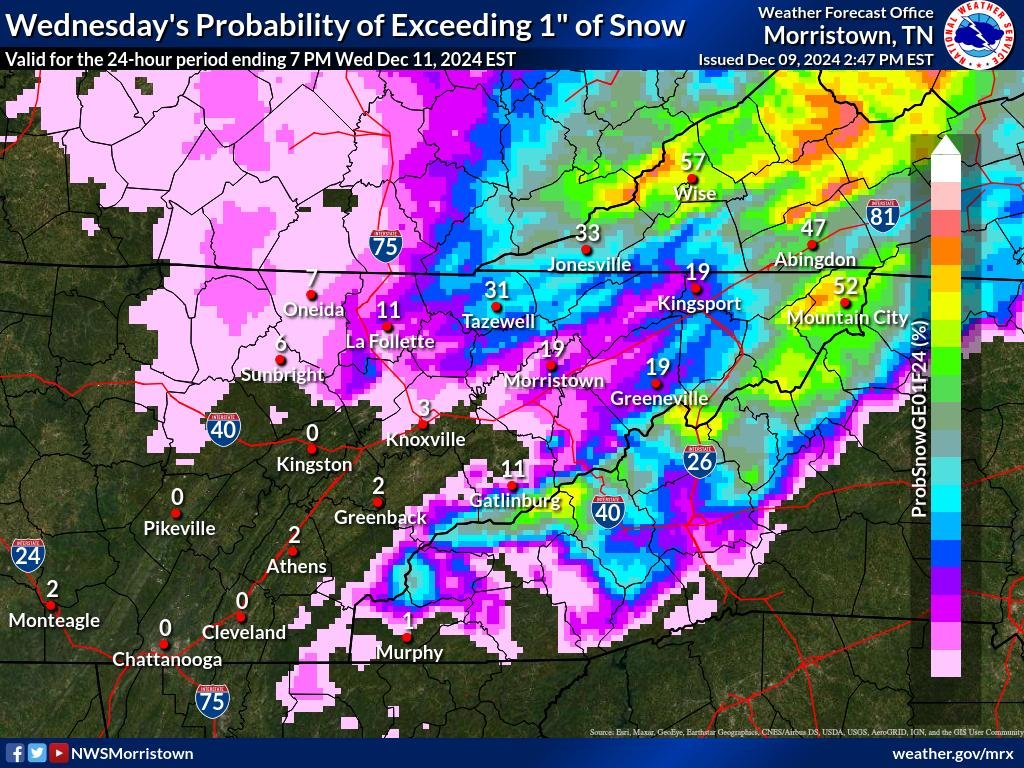
While snowfall is anticipated across the region, significant uncertainty remains about total snow accumulations. Current forecasts suggest that favored higher elevations could see around 1 inch of snowfall, while lower valley locations are expected to receive only light accumulations, if any. Valley areas from far northeastern Tennessee into southwestern Virginia are most likely to experience light snowfall, though totals are projected to be minimal.
Wind and Wind Chill
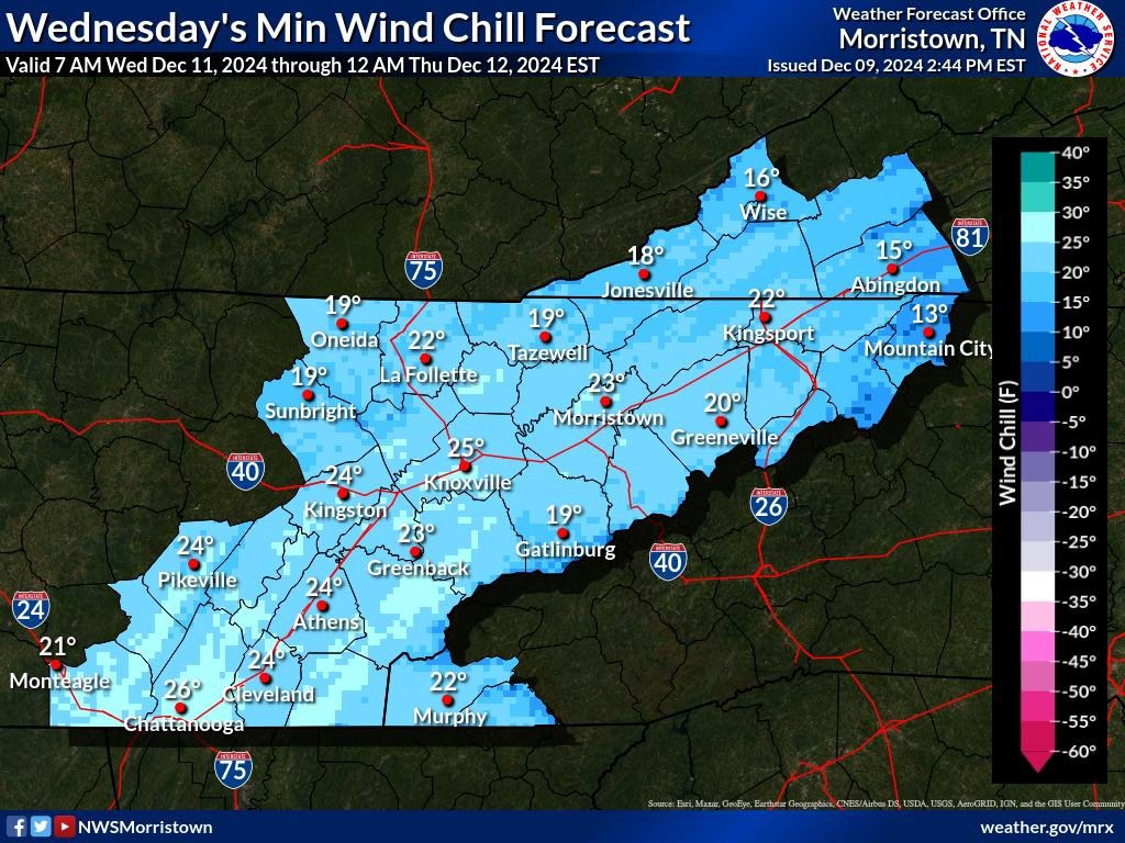
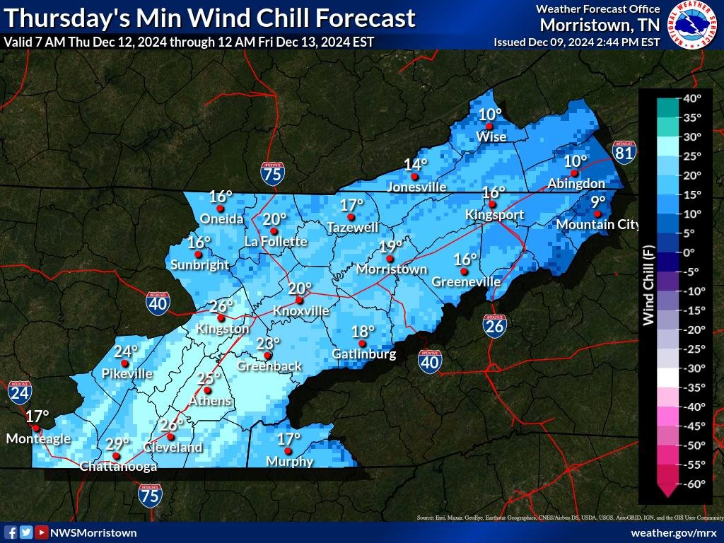
Adding to the wintry conditions, a rapidly deepening surface low to the northeast and advancing high pressure will generate strong, gusty winds, especially across higher elevations. Wind gusts in the Southern Appalachians may approach Wind Advisory levels, creating blustery and hazardous conditions on exposed ridges and mountaintops. Wind chills will plummet, with “feels like” temperatures ranging from the teens to single digits in some areas, significantly increasing the risk of frostbite with prolonged exposure.
What to Expect
- Timing: Wednesday morning through Wednesday night
- Precipitation: Rain transitioning to snow with snowfall likely in higher elevations and possible light accumulation in valley areas
- Temperatures: Falling throughout the day, with the highest temperature occurring just after midnight
- Snow Accumulation: Around 1 inch in higher elevations; light accumulations possible in valley areas, especially in northeastern Tennessee and southwestern Virginia
- Wind: Gusty winds, especially in higher elevations, with potential for Wind Advisory-level gusts
- Wind Chill: Feels-like temperatures in the teens to single digits, especially in exposed areas and higher terrain

