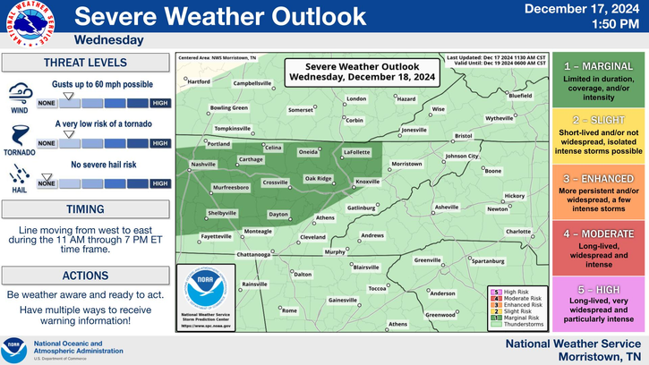
The Storm Prediction Center (SPC) has issued a Level 1 risk for severe storms on Wednesday, affecting the plateau and valley regions, including the city of Knoxville.
Timing and Storm Progression The line of storms is forecasted to enter the region around 3 PM, pushing eastward until approximately 9 PM. This timing means the afternoon and evening commute could be impacted, so drivers are advised to remain cautious and avoid flooded roadways. As the front advances, residents can expect rapidly changing weather conditions, with the possibility of intense wind gusts and heavy rainfall.
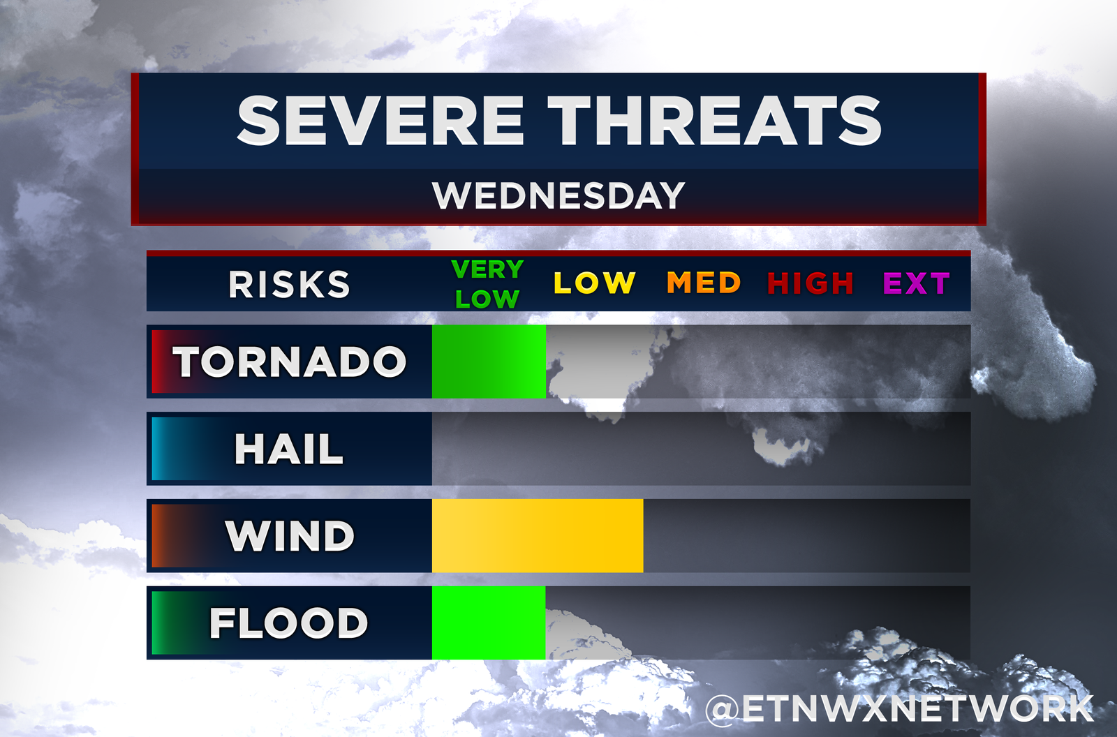
Primary Threats The most significant threat posed by this storm system is damaging winds, with gusts reaching speeds of up to 60 mph. Such winds can knock down trees, power lines, and unsecured outdoor objects.. There is also a chance for a brief, isolated tornado, which can develop quickly within the line of storms.
Additionally, the heavy rain accompanying these storms increases the risk of flash flooding, especially in low-lying and flood-prone areas of the valley. Flash flooding can occur suddenly, turning roads into dangerous waterways.


