NOAA and Air Force Hurricane Hunter aircraft have been investigating Hurricane Milton this evening, gathering vital data including center fixes, flight-level wind measurements, and dropsonde readings. According to the latest observations, Milton has regained Category 5 strength, with maximum sustained winds near 145 knots (167 mph) and a central pressure as low as 902 mb. However, more recent readings indicate a slight weakening, with central pressure rising and winds adjusted down to 140 knots (161 mph). This update aligns with the latest subjective Dvorak intensity estimates from both TAFB and SAB.
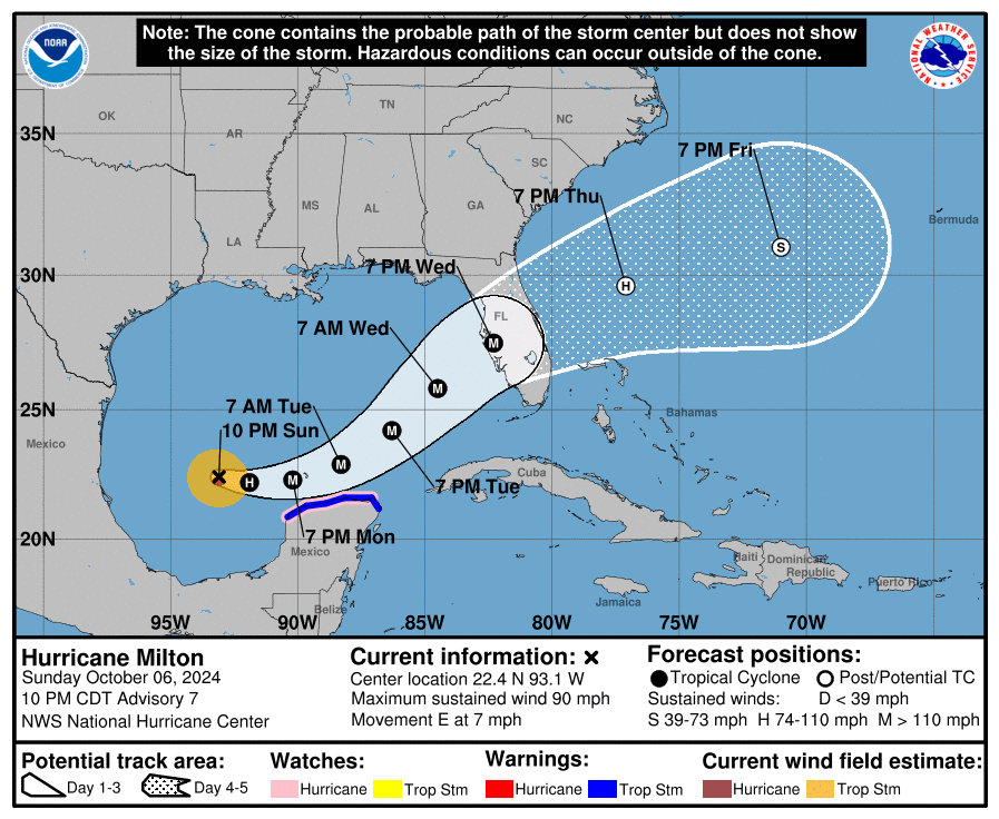
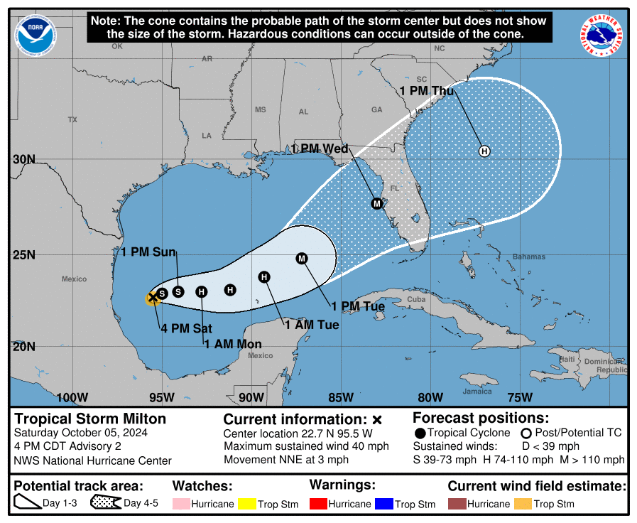
Satellite imagery and aircraft fixes indicate that Milton’s movement is gradually turning left, now estimated at a heading of about 055 degrees at 10 knots. The hurricane is being guided by the interaction between a trough over the Gulf of Mexico and a ridge near the Greater Antilles. Milton is expected to move northeastward on Wednesday with a slight increase in forward speed, bringing the center of the hurricane to the Florida Gulf Coast within approximately 24 hours. After landfall, the system is expected to turn east-northeastward and eventually eastward, moving over the southwestern Atlantic, off the southeastern U.S. coast. The official track forecast remains similar to the previous projections and is generally positioned slightly north of the model trackers, closely following a blend of the GFS and ECMWF model solutions. It is crucial to note that, even at 24 hours out, pinpointing the exact landfall location remains challenging.
Milton is expected to maintain major hurricane status while crossing the eastern Gulf of Mexico toward Florida’s west coast. Increased vertical wind shear is likely to induce some weakening, but Milton is still expected to be an extremely dangerous major hurricane when it reaches land. Furthermore, early stages of extratropical transition may occur as Milton makes landfall, potentially providing additional baroclinic energy that could slow the weakening process. The current National Hurricane Center (NHC) intensity forecast is near the higher end of model guidance. Once over the Atlantic, the system is expected to become embedded within a frontal zone, transitioning to an extratropical system within 72 hours.
The wind field of Hurricane Milton is anticipated to grow considerably in size by the time the center moves over Florida. A large area of tropical storm and hurricane-force winds could also occur on the northwest and back sides of the storm as Milton interacts with a frontal boundary and begins its extratropical transition. This means damaging winds, life-threatening storm surge, and heavy rainfall will extend well beyond the official forecast cone. Residents in Florida need to take this very seriously and closely follow instructions from local emergency management officials. Evacuations and preparations should be completed tonight. Milton has the potential to be one of the most destructive hurricanes to impact west-central Florida on record.

![[Image of initial wind radii]](https://www.nhc.noaa.gov/storm_graphics/AT14/refresh/AL142024_current_wind+png/212734_current_wind_sm.png)
![[Image of probabilities of 34-kt winds]](https://www.nhc.noaa.gov/storm_graphics/AT14/refresh/AL142024_wind_probs_34_F120+png/212734.png)


