Hurricane Milton continues to strengthen as it churns in the Gulf of Mexico, with its center now embedded within a well-defined Central Dense Overcast, a sign of intensifying activity. The storm is producing extremely powerful convection, with cloud tops reaching temperatures colder than -80°C. Data from NOAA Hurricane Hunter aircraft indicate that the circulation remains highly symmetric, with minimal vertical tilt between 1 and 5 kilometers above the surface—a characteristic of an increasingly organized and powerful hurricane.
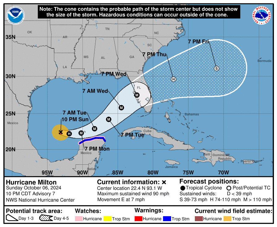
According to observations from both Air Force and NOAA Hurricane Hunters, Milton’s central pressure continues to fall, with its sustained winds now reaching 80 knots (around 92 mph). These signs point to ongoing strengthening as the storm moves steadily eastward.
Hurricane Milton’s Path and Influences
Milton is currently tracking eastward at approximately 6 knots, influenced by two main weather systems: a broad mid-level trough over the Gulf of Mexico and a low- to mid-level cyclone over the eastern Gulf. Over the next couple of days, the cyclone influencing Milton is expected to shift eastward, allowing the mid-level trough to exert more influence. This should cause the hurricane to begin turning northeastward, accelerating in speed as it approaches the west coast of Florida.
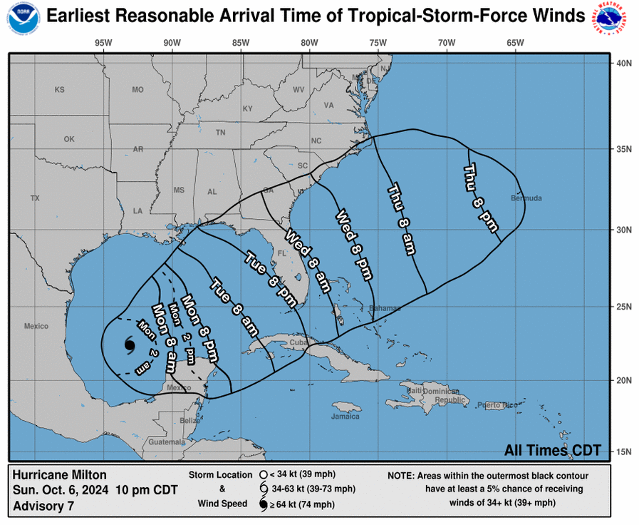
The National Hurricane Center (NHC) projects that Milton will make landfall along Florida’s Gulf Coast within 72 hours, then cross the state before moving east-northeastward into the Atlantic. While the predicted track remains consistent with earlier forecasts, there is still a 100-mile margin of error for day-three projections, reminding residents not to focus solely on the exact path.
Forecast: Rapid Strengthening and Potential Category 4 Status
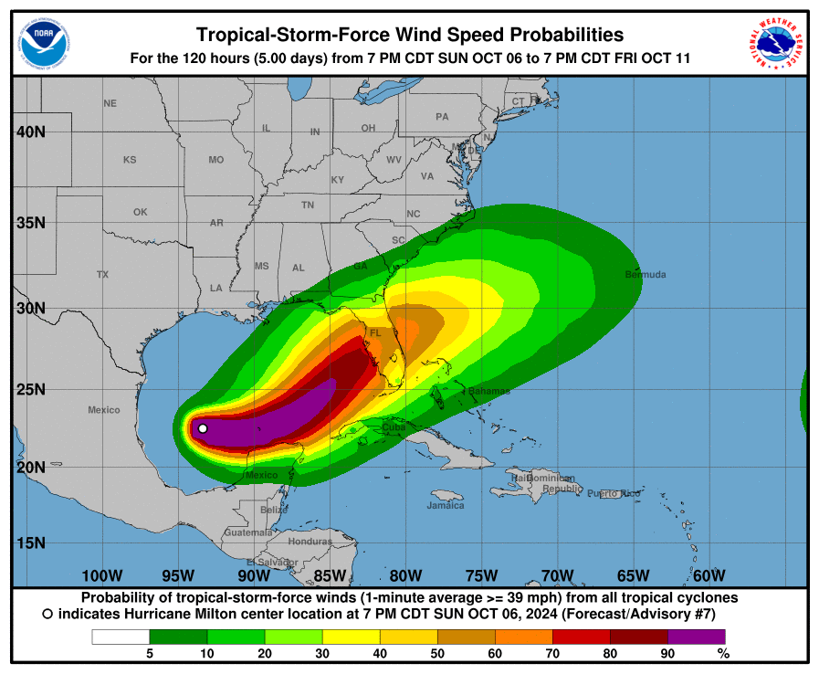
Milton is traversing waters with very high oceanic heat content, a crucial ingredient for rapid intensification. The storm is also in an environment with minimal wind shear and abundant moist air at low to mid-levels of the atmosphere, conditions that are expected to persist for the next 24-48 hours. As a result, forecasters predict Milton will rapidly intensify into a Category 4 hurricane in the coming days.
However, beyond 48 hours, increasing upper-level westerly winds over the northern Gulf of Mexico will likely introduce more wind shear, which could weaken the storm slightly before it reaches the Florida coast. Even with some weakening, Milton is expected to remain a large and powerful hurricane at landfall, capable of producing life-threatening storm surge, heavy rainfall, and damaging winds along the Florida coastline.