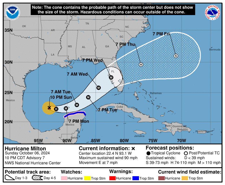
Hurricane Milton is being watched closely by aircraft from the U.S. Air Force and NOAA. Earlier, they found that Milton’s central pressure dropped to 897 mb, making it one of the strongest hurricanes ever recorded in the Atlantic. However, as the storm moved, its pressure rose a bit, and its winds dropped slightly to 145 knots (about 167 mph). This is likely due to an eyewall replacement, where the storm reorganizes itself. Even though it’s weakened a little, Milton is still a very dangerous Category 5 hurricane.
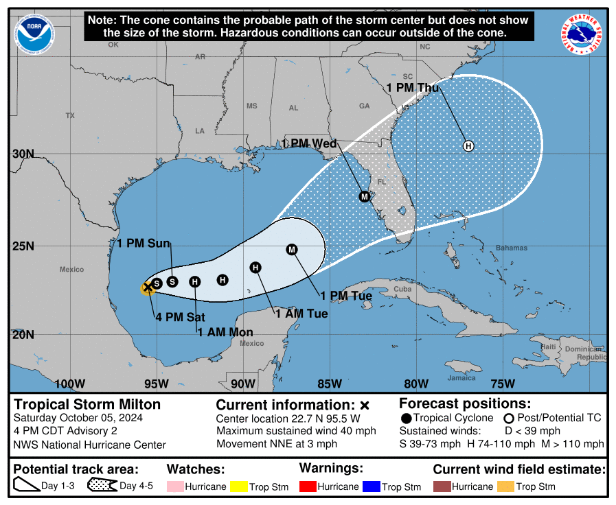
Right now, Milton is moving east at around 8 knots and is expected to pass close to the northern coast of the Yucatan Peninsula tonight and early Tuesday. After that, it will likely pick up speed and head northeast across the Gulf of Mexico, reaching the Florida Peninsula by Thursday. Forecasters believe it will continue moving across the Atlantic after that, but by then, it may start losing some of its tropical storm characteristics.
Milton is currently in an environment with low wind shear and very warm ocean waters, which has allowed it to remain strong. However, wind conditions are expected to change within the next 24 hours, likely weakening the storm as it gets closer to Florida. Even though its winds may slow down, Milton is expected to grow larger, meaning more people could be affected by dangerous winds and storm surges.
People in Florida, especially in the west-central part, should take this storm seriously. Milton has the potential to be one of the most destructive hurricanes to hit the area. Everyone should follow instructions from local emergency officials to stay safe as this powerful storm approaches.
![[Key Messages]](https://www.nhc.noaa.gov/storm_graphics/AT14/refresh/AL142024_key_messages+png/032137_key_messages_sm.png)


![[Image of probabilities of 34-kt winds]](https://www.nhc.noaa.gov/storm_graphics/AT14/refresh/AL142024_wind_probs_34_F120+png/032137.png)


