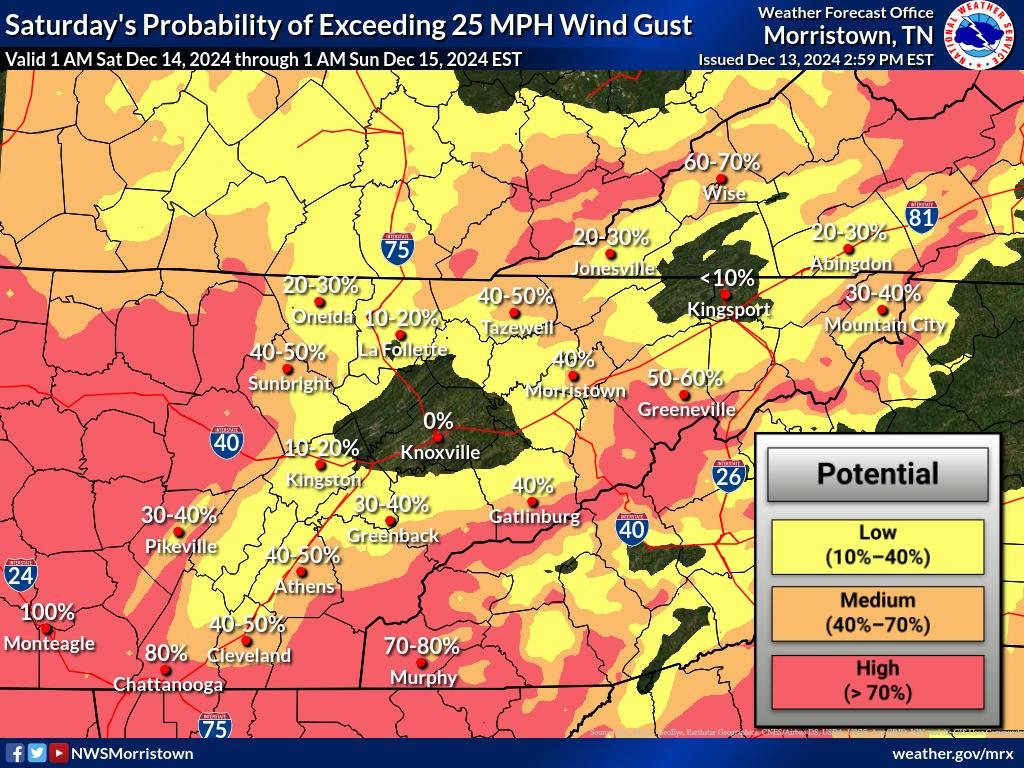
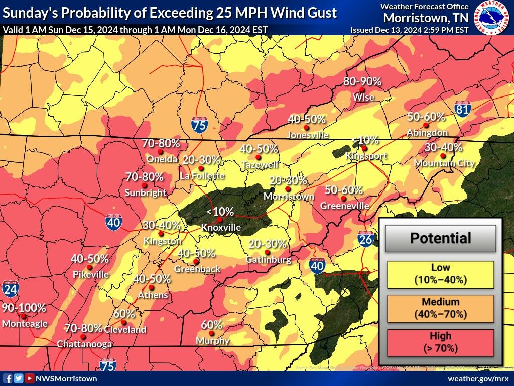
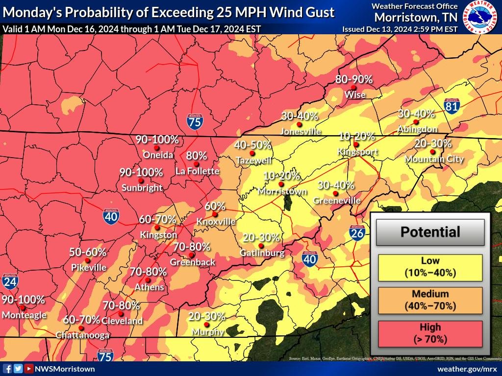
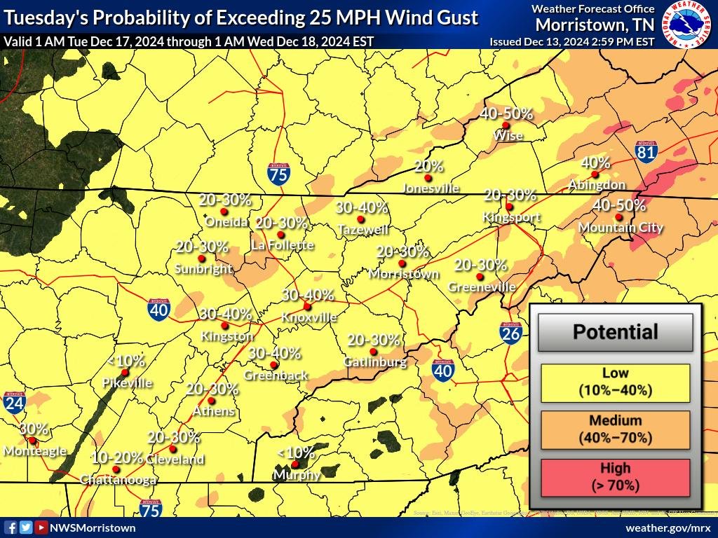
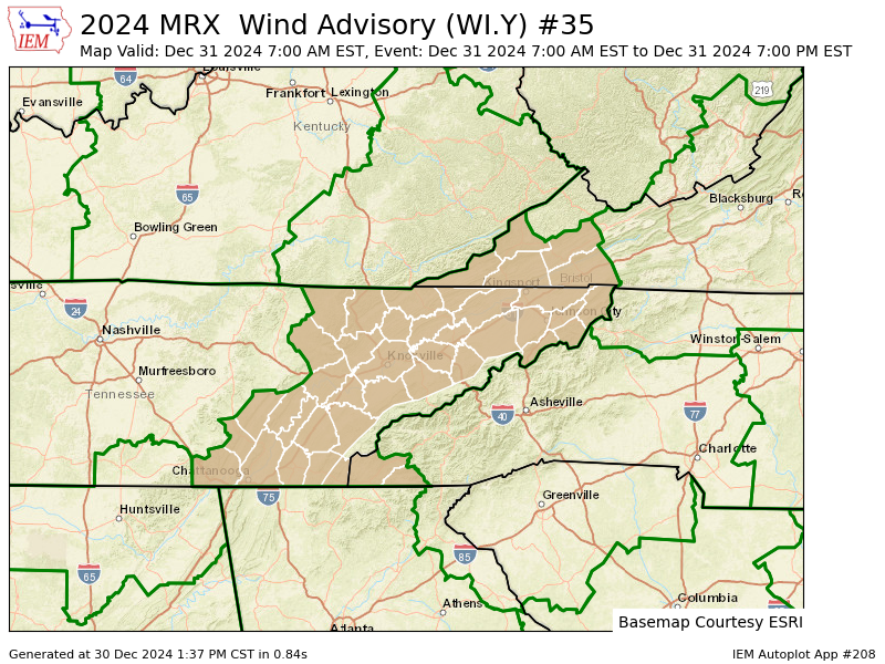
The latest High-Resolution Ensemble Forecast (HREF) probabilities indicate a significant likelihood of strong winds impacting the East Tennessee mountains and foothills. Data suggests an 80% to 100% chance of wind gusts reaching or exceeding 40 mph, meeting Wind Advisory criteria. Portions of the foothills that are particularly prone to mountain wave winds, such as Camp Creek, are also included in this high-probability zone.
Meanwhile, the Cumberland Plateau faces a 50% to 80% probability of experiencing gusts over 40 mph. However, the likelihood of winds reaching High Wind Warning criteria (gusts of 57 mph or higher) in the East Tennessee mountains remains low, with current HREF probabilities ranging from 20% to 40%.
Given this data, the National Weather Service has issued a Wind Advisory for the East Tennessee mountains and foothills. The Cumberland Plateau is currently excluded from this advisory, but forecasters will continue to monitor updated high-resolution models and may include it in future forecasts if conditions warrant.
WIND ADVISORY IN EFFECT FROM 4 PM SATURDAY TO 10 AM EST SUNDAY
What to Expect:
- Winds: Southeast winds of 15 to 25 mph with gusts up to 50 mph are expected. Isolated gusts could reach up to 60 mph.
- Areas Affected: Blount Smoky Mountains, Cocke Smoky Mountains, Johnson, Sevier Smoky Mountains, Southeast Carter, Southeast Greene, Southeast Monroe, and Unicoi Counties.
- Timing: From 4 PM Saturday through 10 AM EST Sunday.
Potential Impacts:
- Gusty winds may blow around unsecured objects.
- Tree limbs could be downed, leading to possible power outages.
- Driving conditions may become hazardous, especially for high-profile vehicles.
Precautionary/Preparedness Actions:
- Secure loose outdoor objects such as patio furniture, decorations, or lightweight equipment.
- Be prepared for potential power outages.
- Exercise caution while driving, particularly if operating large or high-profile vehicles.

