A period of active weather is anticipated to begin Friday and continue through Sunday night or early Monday morning across the region. Here’s what you can expect:
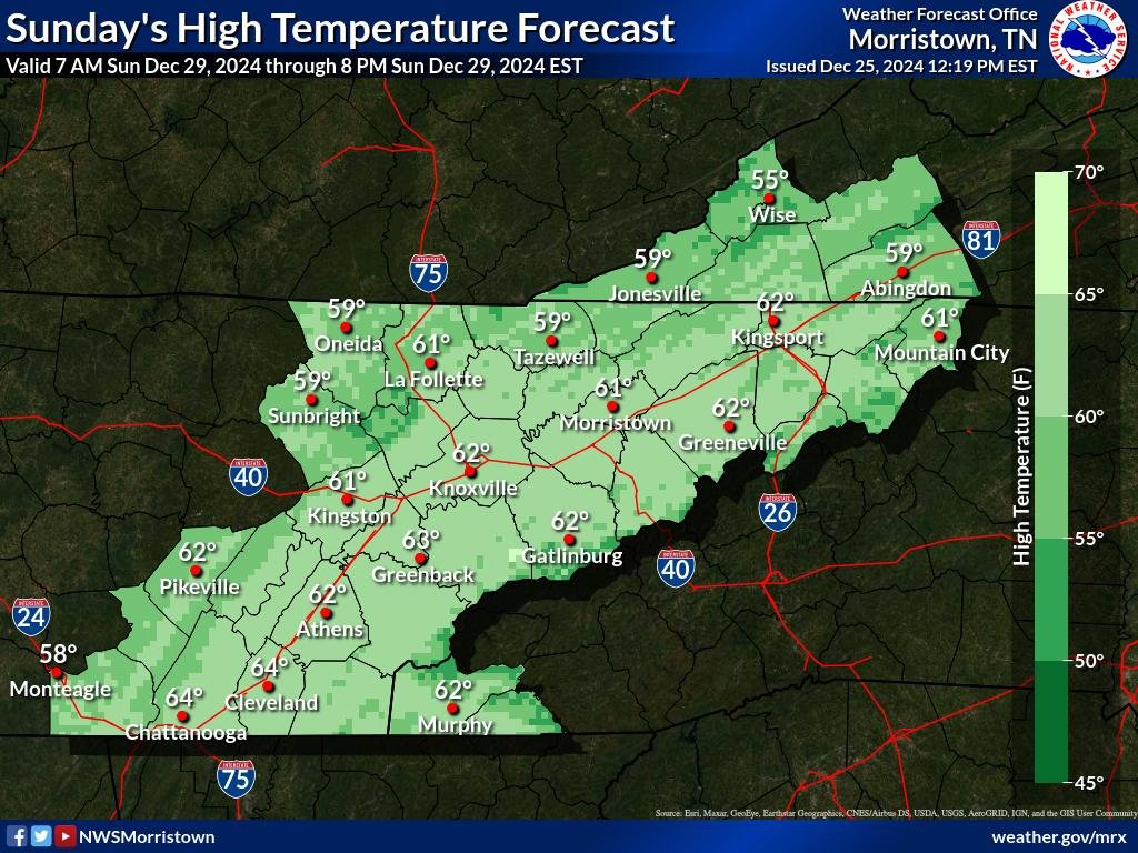
Unseasonably Warm Temperatures
Highs across the area will remain 10-15 degrees above normal for the remainder of the week into early next week. This warm stretch sets the stage for changes as a ridge slowly shifts eastward on Friday.


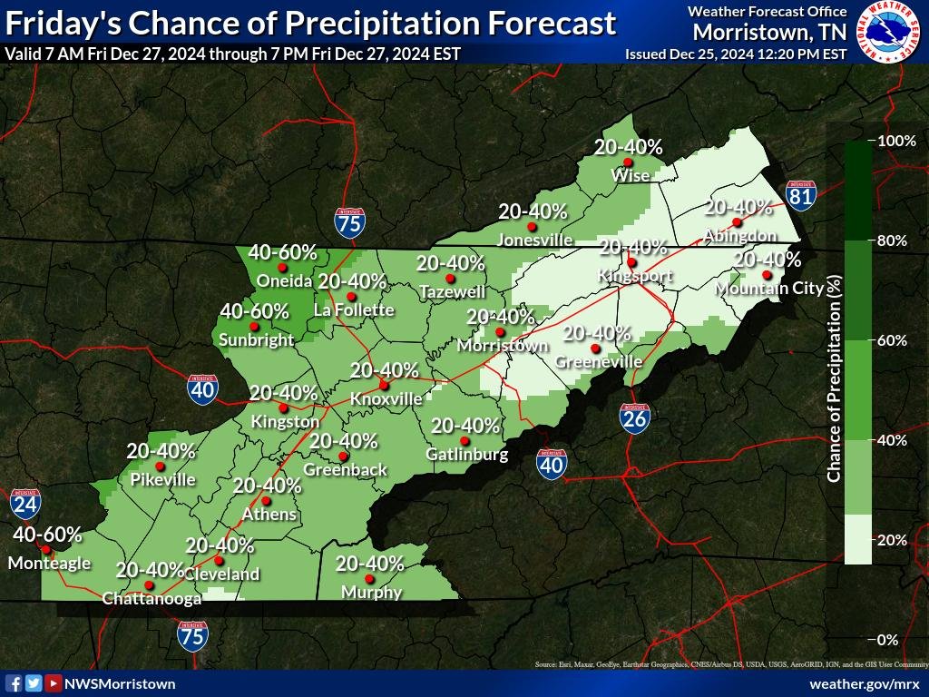
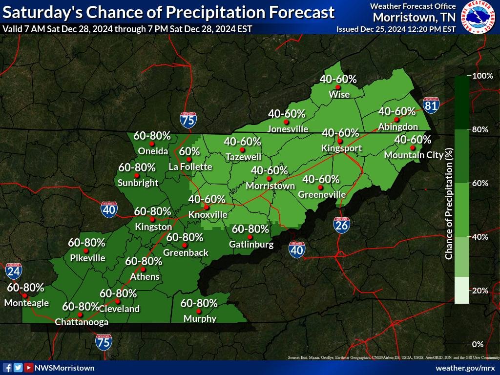
Rain Chances Increase Over the Weekend
Rain will begin moving into the region on Saturday and continue into Sunday, with rainfall totals projected to range between 1-2 inches by Sunday. However, areas south of I-40 could see higher amounts, increasing the potential for isolated flooding. The Weather Prediction Center (WPC) has issued a Level 1 Marginal Risk for flash flooding on Sunday, particularly in the lower valley and plateau areas.
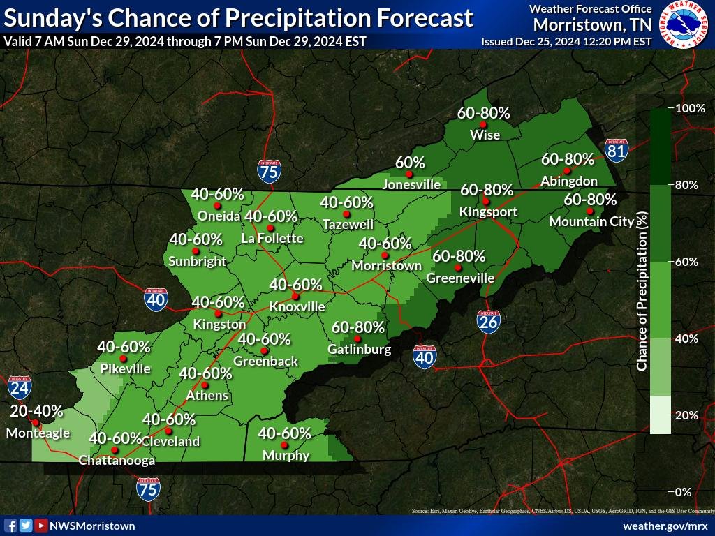
While localized flooding is possible, the ongoing drought conditions across the region will likely prevent major flooding concerns.
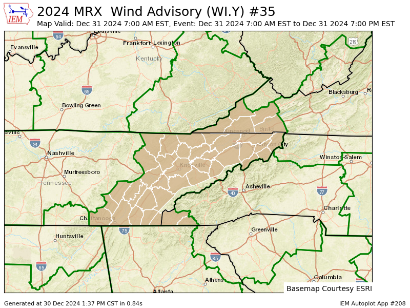
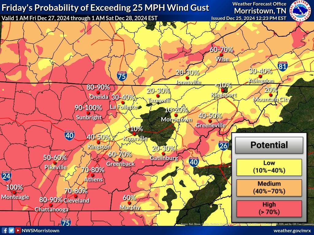
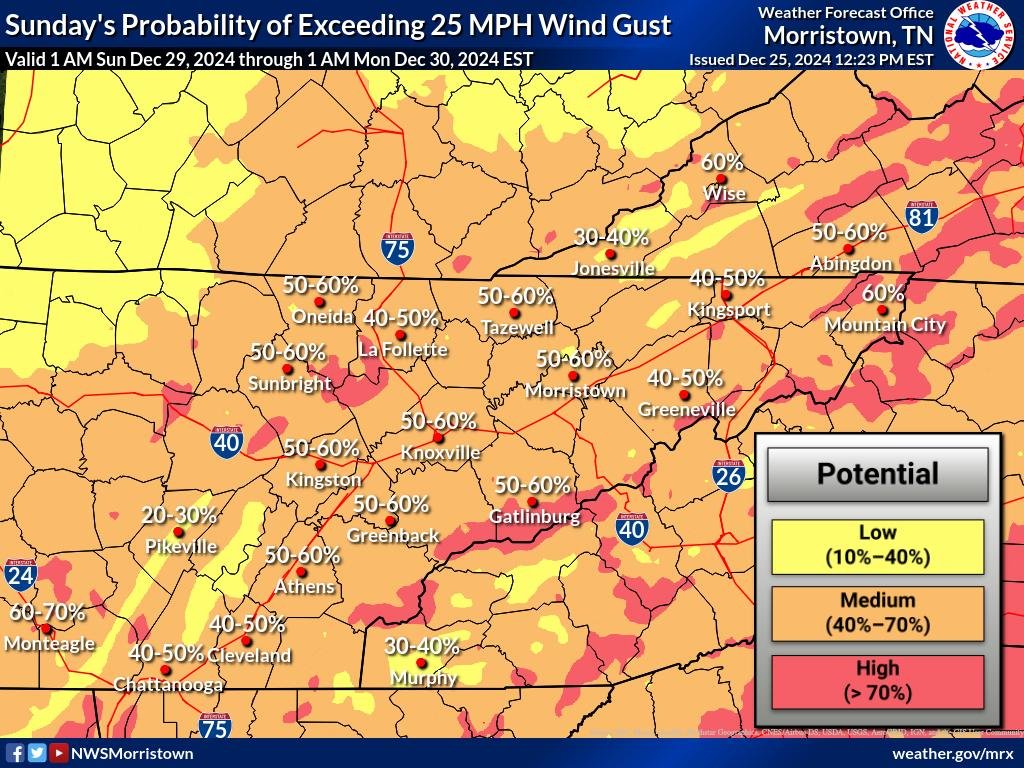
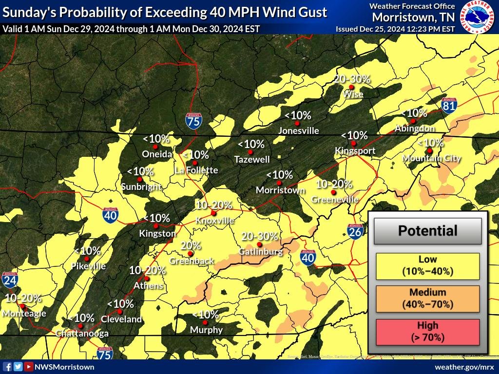
Wind Impacts in Higher Elevations
Mountain wave winds will also be a factor, starting Friday afternoon and lasting into Friday night, with a second round expected Saturday night. Winds in higher elevations and foothills could range from 20-30 MPH, with gusts reaching up to 50 MPH in some areas. The National Weather Service (NWS) has mentioned the possibility of issuing a Wind Advisory due to these conditions.


What to Watch For
- Rainfall Totals: 1-2 inches, with higher amounts south of I-40.
- Flooding Risk: Isolated flooding in the lower valley and plateau; major flooding unlikely due to drought.
- Winds: Strong gusts up to 50 MPH in higher elevations; Wind Advisory possible.
Stay updated on the latest forecasts and prepare for changing conditions this weekend. Be cautious of localized flooding and windy conditions, especially in higher terrain.