Sorting by

×
Headlines

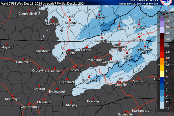
Snow Accumulation Expected Across Higher Elevations Friday & Saturday

A fast-moving shortwave trough combined with a clipper low-pressure system is set to impact the Ohio Valley and Central Appalachians on Friday. As the system moves southeast, it will bring a shift to northwest flow behind a cold front, creating conditions favorable for orographic lift. Timing and Duration The weather system will begin affecting the…

Read More

Potential Winter Weather Event for Late Next Week

Forecast models, including the GFS and Euro, are signaling the potential for a winter weather event late next week, most likely around Thursday. While there is still uncertainty regarding temperatures and the timing of precipitation type changes, we are closely monitoring the situation as it develops. This weather event is expected to follow the passage…

Read More

Mountain Snow Event Expected Wednesday: Rain Transitions to Snow with Plunging Temperatures and Gusty Winds

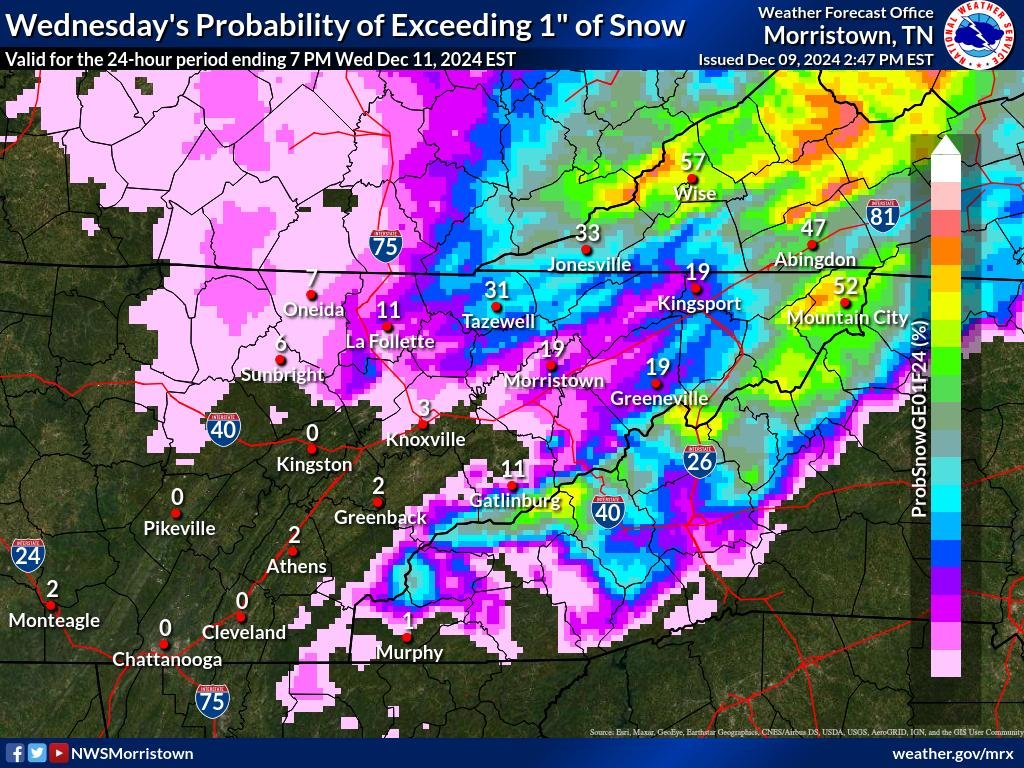
A significant winter weather event is on the horizon for the mountains, beginning early Wednesday morning and continuing through Wednesday night. As a weather front sweeps through the region, rain will transition to snow, bringing the potential for accumulating snowfall in higher elevations and light snow in some valley locations. Cold Air Surge and Temperature…

Read More

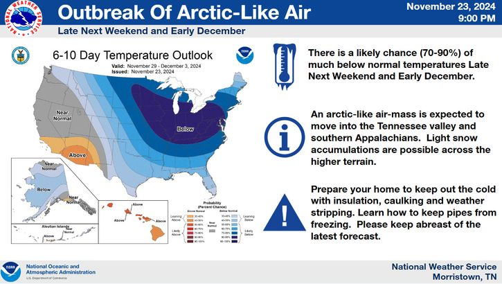
Arctic-Like Air to Sweep Across Tennessee Valley and Southern Appalachians

A powerful arctic air mass is forecast to bring significantly colder temperatures to the Tennessee Valley and the Southern Appalachian region late next weekend and into early December. The National Weather Service (NWS) projects a 70-90% likelihood of much below-average temperatures between November 29 and December 3, 2024. What to Expect: Preparations: The NWS advises…

Read More

Winter Storm to Bring Wind, Rain, and Snow Across the Area Thursday and Friday

Residents should brace themselves for a significant winter storm expected to bring a mix of wind, rain, and snow over Thursday and Friday. A powerful low-pressure system is forecast to rapidly develop on Wednesday, leading to widespread impacts across the region. Timing and Initial Impacts The system is projected to intensify rapidly on Wednesday, delivering…

Read More

Winter Weather Event to Impact Higher Elevations: Tri-Cities Metro May See Light Snow; Valley Showers Expected

Residents across the region should prepare for a major winter weather event set to bring heavy snow, strong winds, and frigid temperatures. Higher elevations are forecasted to bear the brunt of the storm beginning late Wednesday and continuing into Thursday. Meanwhile, the Tri-Cities Metro area could see light snow accumulations, and valley regions are expected…

Read More