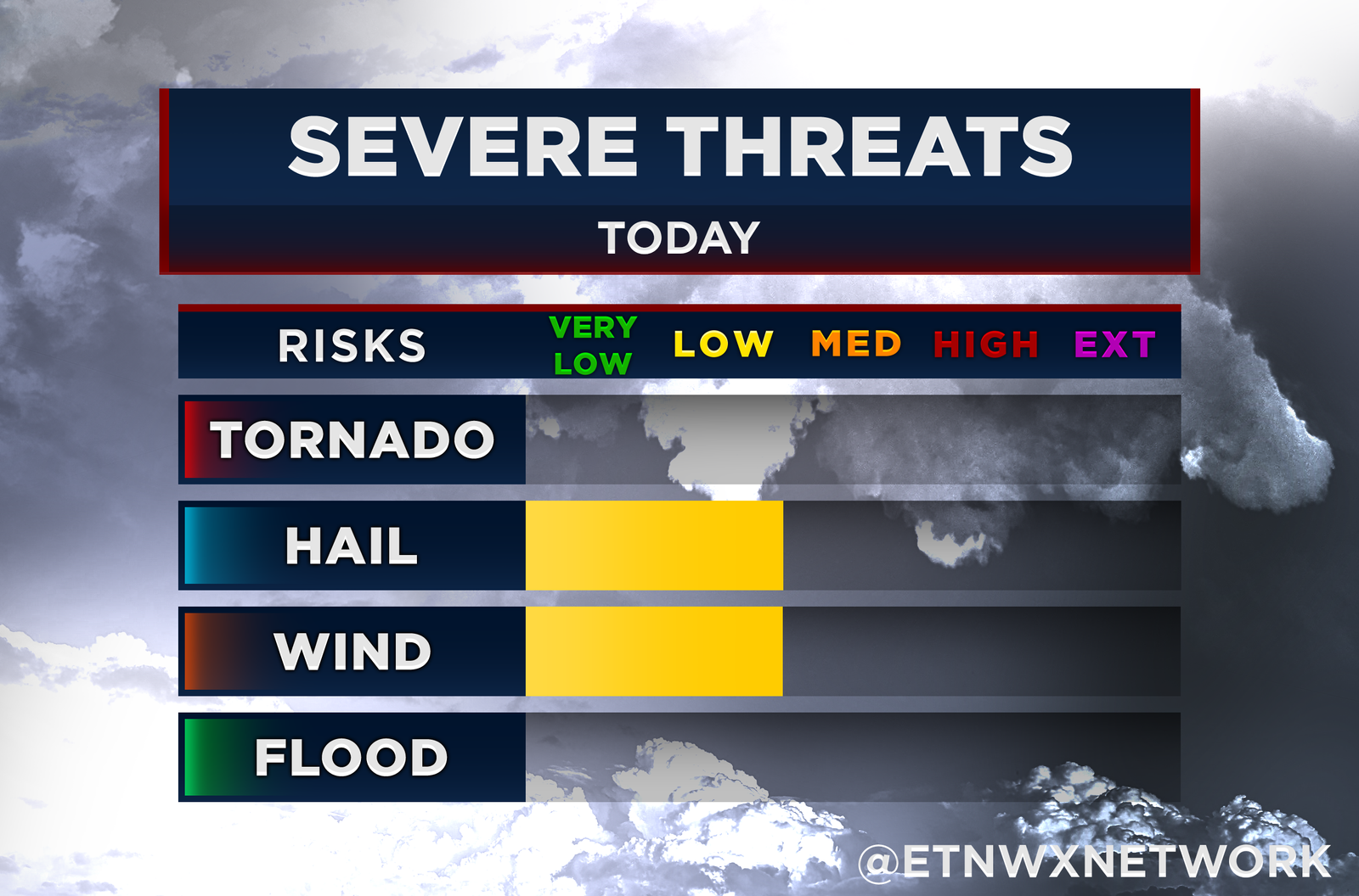
10 PM UPDATE: So far, more shower activity has developed over the valley than originally forecasted, which is currently preventing the atmosphere from building the instability needed for strong storms to form. While the upper-level spin over our area remains in place, storms will need to tap into it for any tornado threat to materialize. If the current trend continues, the tornado risk could drop significantly—though it’s too early to say for certain. The jet stream over the area remains strong, meaning that any storm that does develop could still transfer stronger winds down to the surface, keeping the damaging wind threat active. However, overall conditions appear more modest, which could limit additional storm development along the line. As a result, we may only see the “leftovers” from storms currently moving through Alabama. While the threat appears limited at this time, do not let your guard down. Make sure you have reliable ways to receive warnings overnight, especially if you’re asleep. Keep weather radios and alert systems ready to wake you up in case warnings are issued.
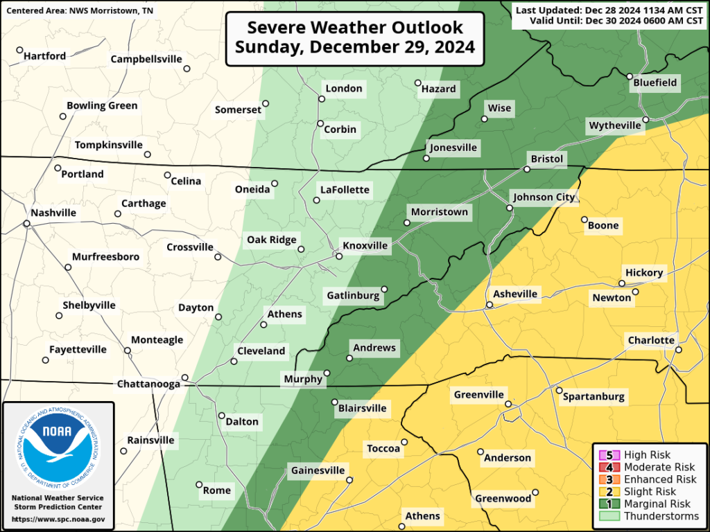
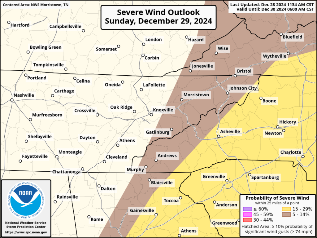
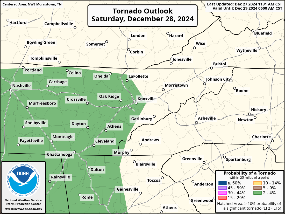
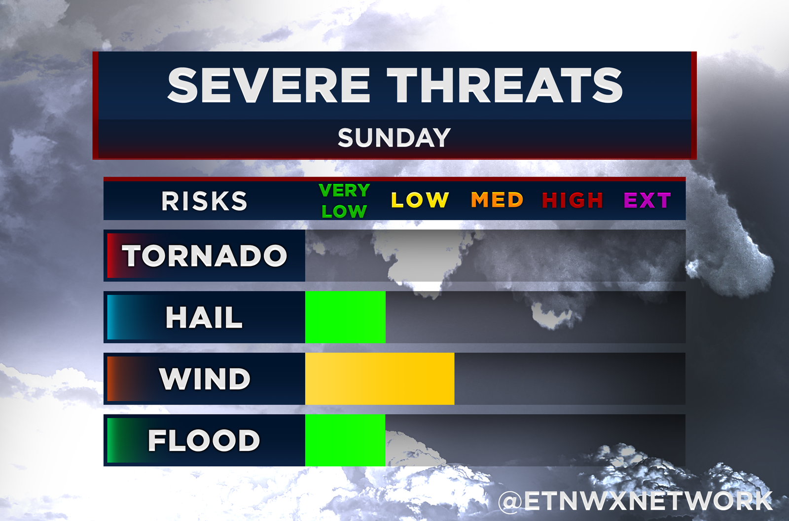
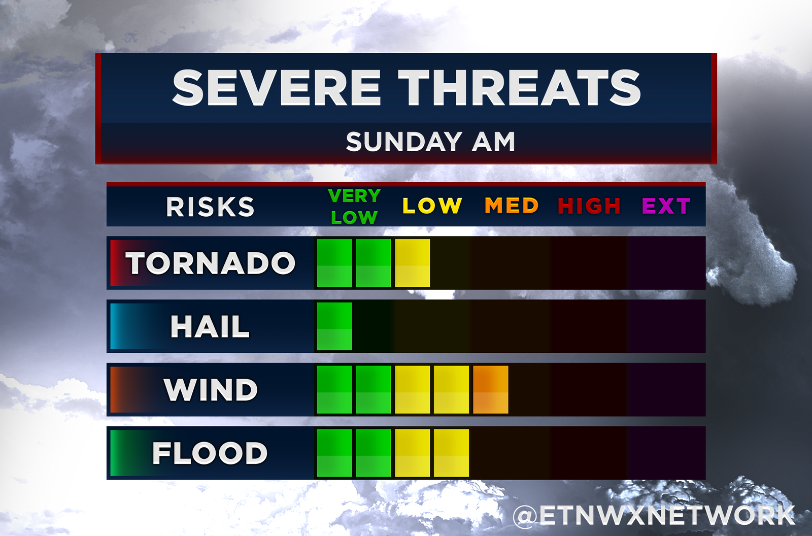
An ETWN Alert Day has been issued for Sunday morning, beginning at 3 AM and continuing through noon. A line of strong to severe storms is expected to move into the area by 4 AM, progressing eastward throughout the morning hours. The primary threat will be damaging wind gusts, with the potential for an isolated tornado or two, particularly in the lower valley region.
How to Stay Safe: Getting Tornado Warnings at Night
Severe storms during overnight hours can be especially dangerous, as many people are asleep and unaware of changing conditions. Here are some effective ways to ensure you receive tornado warnings during the night:
- Weather Radio: Invest in a NOAA weather radio with an alert function. These radios are designed to sound an alarm for warnings, even when turned off.
- Mobile Alerts: Enable emergency alerts on your smartphone. Many weather apps also offer customizable notifications for severe weather.
- Family Safety Plan: Make sure everyone in your household knows the plan if a tornado warning is issued, including where to take shelter immediately.
What is a QCLS Tornado?
A QCLS tornado (Quasi-Linear Convective System tornado) is a type of tornado that forms within a line of strong thunderstorms, known as a squall line. These tornadoes can be particularly challenging to predict, as they often develop quickly and can be short-lived but intense. Despite their brief nature, QCLS tornadoes can cause significant damage, so it’s crucial to take warnings seriously.
Live Coverage and Updates
In the event of tornado warnings, live coverage will be provided in collaboration with FirstWARN Tri-Cities. You can tune in through multiple platforms:
- Social Media: Follow updates and live streams on X (@etnwxnetwork).
- Radio Streaming: Listen live on B106 Tri-Cities and i92 Knoxville via the iHeart Radio app.
- Timely Updates: Stay informed with ongoing updates on X.
By staying alert and prepared, you can keep yourself and your family safe during Sunday morning’s severe weather threat.